tchinggiz

Baud
Son patrimoine

Baod

Baod
( Baud )
baud-4
Baud: Soleil d'été...
🎲 ⤇ Les Agneillards, des agneaux ?

Baud

■ Baud: Son patrimoine

Le patrimoine de Baud mérite intérêt et visite. Qu'il soit petit ou grandiose patrimoine, il témoigne de la vie locale passée et présente.

Ce patrimoine est, peut-être et aussi, un patrimoine naturel, des paysages, une foule de petits détails, un linteau de porte ou une sculpture de porte ou autres. Vous saurez les apprécier si vous les regardez avec un œil curieux ; ils sont aussi témoignages d'un riche passé que nous offrent nos ascendants.

Sachez profiter de ce don remarquable !

Merci à wikipédia et autres d'arrêter de plagier nos textes et travaux.


Baud

Baud
  • Français: Baud
  • Breton: Baod
    ( Brezhoneg )
  • Population: 6 246 hab
    Gentilé: Baldiviens
  • Type: Commune
  • Superficie: 48,09 km²
    Densité: 129.88 hab/km²
  • Latitude: 47°52'27" N
    Longitude: 3°1'17" W
  • Latitude: 47.874141
    Longitude: -3.021337
  • pages: 24
  • Ce jour: ✝  Jérôme de Dalmatie
Allée couverte du Prioldi
◎ Allée couverte du Prioldi - Alez-Toet ar Prioldi
 Lat: 47.848312° - Long: : -3.040956° - Le Prieuré - Monuments mégalithiques Néolithique - Pédestre ⤇ 

Auberge du Cheval-Blanc
◎ Auberge du Cheval-Blanc - Ostaleri ar Marc'h Gwenn
 Lat: 47.876923° - Long: : -3.019605° - 16 rue de Pontivy - Maison remarquable XVIII° - Privée ⤇ 

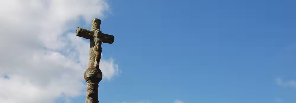
Calvaire de Ténuel
◎ Calvaire de Ténuel - Kalvar
 Lat: 47.868232° - Long: : -3.045356° - Ténuel - Croix ou Calvaire XVII° - Parking aisé ⤇ 

Chapelle du Clayo
◎ Chapelle du Clayo - Chapel ar C'hleuioù
 Lat: 47.873965° - Long: : -2.977399° - Le Clayo - Chapelle XIX° - Respectez ce lieu de culte ⤇ 

Chapelle Notre-Dame des Neiges
◎ Chapelle Notre-Dame des Neiges - Chapel Itron-Varia an Erc'h
 Lat: 47.849762° - Long: : -3.037426° - Le Prieuré - Chapelle XVII° - Disparue ⤇ 

Chapelle Notre-Dame-de-la-Clarté
◎ Chapelle Notre-Dame-de-la-Clarté - Chapel Intron-Varia ar Sklaerder
 Lat: 47.875191° - Long: : -3.019420° - 1 Plasenn Le Sciellour - Chapelle XIV° - Respectez ce lieu de culte ⤇ 

Chapelle Saint-Cado
◎ Chapelle Saint-Cado - Chapel Sant Kado
 Lat: 47.854413° - Long: : -3.062413° - Le Clayo - Chapelle XVII° - Respectez ce lieu de culte ⤇ 

Chapelle Saint-Gildas
◎ Chapelle Saint-Gildas - Chapel Sant Gweltaz
 Lat: 47.885936° - Long: : -3.065884° - Bourron - Chapelle XVII° - Respectez ce lieu de culte ⤇ 

Chapelle Saint-Jacques
◎ Chapelle Saint-Jacques - Chapel Sant Jakez
 Lat: 47.891990° - Long: : -3.036642° - Cran - Chapelle XVIII° - Respectez ce lieu de culte ⤇ 

Chapelle Saint-Mandé
◎ Chapelle Saint-Mandé - Chapel Sant Vaodez
 Lat: 47.872919° - Long: : -2.999761° - Bourron - Chapelle XVIII° - Disparue ⤇ 

Château de la Villeneuve
◎ Château de la Villeneuve - Kastell ar Gernevez
 Lat: 47.875740° - Long: : -3.010295° - 25 Route de Locminé - Château XVII° - Domaine privé ⤇ 

Château de Quinipily
◎ Château de Quinipily - Kastell Kinipili
 Lat: 47.868860° - Long: : -3.034203° - Quinipily - Château XVII° - Domaine privé ⤇ 

Cimetière municipal
◎ Cimetière municipal - Bered Kêr
 Lat: 47.880035° - Long: : -3.020711° - 6bis Rue d'Avrillon - Cimetière ou tombeau - Respectez ce lieu ⤇ 

Croix du Crann
◎ Croix du Crann - Kroaz Krann
 Lat: 47.891615° - Long: : -3.036196° - Crann - Monuments mégalithiques Néolithique & XVII° - Parking aisé ⤇ 

Écluse de Saint Adrien
◎ Écluse de Saint Adrien - Skluz Sant Adrian
 Lat: 47.906825° - Long: : -3.076850° - Saint Adrien - Patrimoine marinier XIX° - ⤇ €

Écluse de Trémorin
◎ Écluse de Trémorin - Skluz Tremorin
 Lat: 47.880229° - Long: : -3.082739° - Trémorin - Patrimoine marinier XIX° - ⤇ €

Église Saint-Pierre
◎ Église Saint-Pierre - Iliz Sant Per
 Lat: 47.875191° - Long: : -3.019420° - 1 Plasenn Le Sciellour - Église paroissiale XIV° - Respectez ce lieu de culte ⤇ 

Ferme de Kerallain
◎ Ferme de Kerallain - Atant Keralan
 Lat: 47.878871° - Long: : -3.076445° - Kerallain - Maison remarquable XVII° - Privée ⤇ 

Fontaine de la Clarté
◎ Fontaine de la Clarté - Feuten ar Sklaerder
 Lat: 47.876055° - Long: : -3.016998° - 23 Rue des Fontaines - Fontaine XVI° - Respectez ce lieu ⤇ 

Fontaine de Saint Pierre
◎ Fontaine de Saint Pierre - Feuten Sant Per
 Lat: 47.876055° - Long: : -3.016998° - 23 Rue des Fontaines - Fontaine XIX° - Respectez ce lieu ⤇ 

Fontaine Saint-Michel
◎ Fontaine Saint-Michel - Feuten Sant Mikael
 Lat: 47.868988° - Long: : -3.033502° - Quinipily - Statue - Mémorial XVIII° - Domaine privé ⤇ €

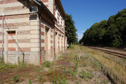
Gare de Baud
◎ Gare de Baud - Gar Baod
 Lat: 47.872611° - Long: : -3.075634° - La Gare - Patrimoine ferroviaire XIX° - Domaine SNCF ⤇ 

Manoir de Coët-Ligné
◎ Manoir de Coët-Ligné - Maner Koad Legneg
 Lat: 47.888002° - Long: : -3.001578° - Coet Ligné - Manoir XVII° - Domaine privé ⤇ 

Manoir de Keraudréno
◎ Manoir de Keraudréno - Maner Keraodrenoù
 Lat: 47.882043° - Long: : -3.058655° - Keraudréno - Manoir XVIII° - Domaine privé ⤇ 

Manoir du Guern
◎ Manoir du Guern - Maner ar Wern
 Lat: 47.886160° - Long: : -3.074345° - Le Guern - Manoir XVIII° - Domaine privé ⤇ 

Menhir du Roffol
◎ Menhir du Roffol - Peul-vaen ar Roc'h Foll
 Lat: 47.908903° - Long: : -3.053538° - Roffol - Monuments mégalithiques Néolithique - Pédestre ⤇ 

Menhir du Roscoet
◎ Menhir du Roscoet - Peul-Vaen ar Roskoed
 Lat: 47.847214° - Long: : -3.067752° - Roscoet - Monuments mégalithiques Néolithique - Pédestre ⤇ 

Vénus de Quinipily
◎ Vénus de Quinipily - Gwrac'h Kinipili
 Lat: 47.868988° - Long: : -3.033502° - Quinipily - Statue - Mémorial Antiquité ? - Domaine privé ⤇ €

◎ Le Monument aux morts -
Lat: 47.875133 - Long: -3.019762 - Près de l'Église Paroissiale